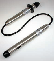
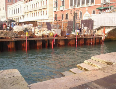
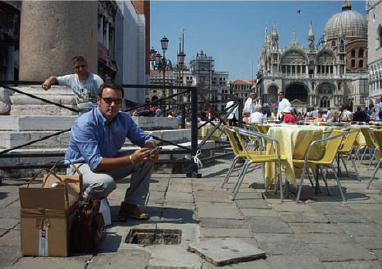
The Italian company S.P.G. s.r.l. has installed several ground water dataloggers on its site on St Mark’s Square in Venice. The loggers are specially designed and can withstand several days of flooding, since St Mark’s Square is periodically flooded during the high tide.
The consortium Venezia Nuova planned to rebuild the wharf opposite St Mark’s Square with innovative technical features. The requirement was to monitor the course of the groundwater, which moved gradually from the area around the site to the buildings behind it.
The zone was subjected to a forced lowering of the groundwater level using a cofferdam,within which the necessary pumping-out took place, in order to be able to work below the water level. The monitoring was an appropriate means to show that when moving from the zone in the direction of the buildings, this forced lowering does not turn out too high, so that it cannot cause any damage. Therefore, level dataloggers were installed on the request of the customer, for the continuous measurement of the variations of the groundwater level inside the piezometers. The loggers were arranged one behind the other, so that they were forming three parallel lines, when moving step by step towards the Doge’s Palace and other historic buildings.
The groundwater measurements, recorded by the dataloggers, were referred to the absolute value of the average sea level for the final analysis, in order to be able to compare them to the data of the tide recorder of Punta Salute.The records of the course of the water level on one of the profiles and the tide, which are combined in a single record for each measuring period, were very helpful for observing the overall course. This also applies to the evaluation and realisation of analyses and interpretations of the course of the groundwater level in comparison with the tidal values and the work carried-out on the site.
The datalogger was installed on the third line. Since this line is farthest away from the pumping station, the tidal influence on the course of the groundwater level is quite low. In general, the measurements recorded during the monitoring period show a clear, linear, unnatural, constant course, which was influenced by the pile planking on the canal-side.
During the forced operation, this planking led to a lowering of the natural piezometric water level which is normally only regulated by the tidal variations. Only locally, at the points marked on the following combined records, one can recognise periods, where the interruption of the pumping-out has caused a natural revival of the variations of the ground water level (marked with a red circle), and in somecases (marked with a yellow circle) the period was too short to enable a natural revival.
In some cases, it is clearly visible how, in the absence of forced lowering operation, the course of the groundwater level in the piezometers follows almost exactly the course of the tide, since they work more or less as tide recorders.The only difference is a lag of several hours and variations, which become less significant the farther one moves away from the shore and closer to St Mark’s Square. The effect of the distance from the shore was also measured during the forced pumping-out, namely via hypothetical typical sections, where the following measurements were taken by sampling one after the other at different times of the day:
Distance Height
(from shore) (above sea level)
7.8m PZ1 0.047m
4.2m PZ2 -0.725m
1.2m PZ3 -1.047m
-0.1m Tide 0.590m
0 Height of shore 0.930m
Situations during the forced operation, where the tide in the canal can freely vary, while the curve remains constant in the shore area. It shows a lower level in the first row, where the effects of the pumping-out are greater, and the trend towards a gradual increase, the further one moves towards the buildings.
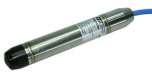
The STS DLN 70 groundwater datalogger enablesthe simultaneous measurement of level,temperature and electrical conductivity in the range from 0-50cm to 0-250m H2O, -5 to 50°C and 0.020 to 20mS/cm. If necessary, the user can retrofit a remote data transmission unit at any time. The logger is characterised by a simple, user-friendly operation, a large memory for 500,000 measured values and a probe diameter of only 24 or 10mm.
The connector versions offer the possibility of cable extension and more flexibility. New software functions can be updated by the user without a trouble some return. The standard lithium battery with a very long life can be easily replaced on the site. Data can be transmitted in ASCII or XML format in standard software like Excel and further processed there.Variable storage intervals depending on pressure or time allow a variety of measurements.The use of various materials such as stainless steel, titanium, polyurethane, polyethylene or Teflon cables ensures a high media compatibility for a wide range of applications such as dumping grounds, hazardous waste, pumping tests, high-water messages, and measurements at rain overfall basins.
Dataloggers Monitor
Water Level in Venice
- by STS Sensor Technik Sirnach AG
- September 14, 2009
- 219 views


